

Croft Ambrey [Yatton Hill]
Good walks are even better shared.
SO4467 : View from Croft Ambrey Hill fort
Eric Marsh Photo source
Overview
Croft Ambrey [Yatton Hill]
Overview
Croft Ambrey, standing at a modest height of 282 meters, is a hill that packs a punch when it comes to history and panoramic views. Located in the picturesque county of Herefordshire, this hill fort offers not just a climb but a journey into the past.
Geology
The geological composition here is intriguing. The hill is primarily made up of Old Red Sandstone, created during the Devonian period. If rocks could talk, these would certainly share tales of ancient oceans and shifting landscapes. Erosion has carved the hill into intriguing shapes, making it a natural wonder for geology enthusiasts.
Routes
The most popular route is the Round Hill Walk, a delightful 4.5 km trek that suits all levels of walkers. The trail weaves through meadows and along the hill's gentle slopes, making it perfect for families and leisurely strollers. Expect to take about 1.5 hours to complete, so don’t forget your afternoon tea!
Summit Features
Reaching the summit, you are greeted by the vestiges of an Iron Age hill fort. The impressive earthworks are designed to impress! There’s also a stone marker that serves as a perfect photo backdrop—a memento to show your friends that you did indeed conquer a hill!
Terrain
Generally, the terrain is grassy, adorned with the occasional rocky section that addsjust enough challenge to keep you on your toes. There’s a good chance you’ll encounter a friendly sheep or two along the way—don’t be alarmed if they give you a quizzical look; it’s just their way!
Views
The views from Croft Ambrey are nothing short of breathtaking. On a clear day, you will be rewarded with magnificent panoramas of the Malvern Hills and the rolling Black Mountains. Come during spring or autumn to catch the most spectacular sights, as the landscape awakens in vibrant colours.
Hazards
While the ascent is not particularly perilous, pay attention to muddy patches, especially after rain. Just think of them as nature’s way of giving your boots a ‘footspa’ treatment—tread carefully!
Access
Access to Croft Ambrey is quite simple. Park in the Croft Ambrey car park (SO443676) and take a short walk to the foot of the hill. Public transport options are sparse, with the nearest bus service running from the village of Yatton. If you’re driving, the town of Leominster is about 5 miles away, providing a range of amenities before or after your hike.
Facilities
Facilities at the hill are non-existent, but Leominster is just a hop away, boasting a selection of cafes and shops to satisfy your post-hike cravings.
History
The hill's name combines Old English elements; 'croft' indicating a small farm and 'Ambrey', referring to its historic significance as a defensive structure. The fortified site tells stories of ancient communities and their resilient spirits.
In summary, Croft Ambrey is a delightful destination for those looking to escape into nature, with enough history and stunning scenery to satisfy even the most discerning adventurer. So grab your walking boots, summon your spirit of exploration, and enjoy all that this charming hill has to offer!
Explore routes near Croft Ambrey [Yatton Hill]
Walks starting near this hill. Open a route to check its map, distance and full itinerary.
Croft Castle: Fishpool Valley and the Gothic pumphouse
View route
Berrington Hall: woodland, lake and Windmill Hill
View route
Mortimer Forest Lower Evens Circuit
View route
Ludlow Town Walls and Castle Walk
View route
Route planning notes
These notes describe possible approaches. Check a route's map and access information when planning your walk.
Round Hill Walk
A gentle circular route around the hill with stunning views and a mix of paths and open fields.
Make a day of it, together
Find someone to share the walk with, or organise a day out along a route you like.
Photo Gallery
View all Photo could not load
SO4467 : View from Croft Ambrey Hill fort
Eric Marsh
 Photo could not load
SO4466 : Inside Croft Ambrey Hill Fort
Des Blenkinsopp
 Photo could not load
SO4466 : View towards Leinthall Earls
Des Blenkinsopp
 Photo could not load
SO4466 : Croft Ambrey
Fabian Musto
 Photo could not load
SO4466 : A shower over the hills around Aymestrey
Philip Halling
 Photo could not load
SO4466 : A shower in the hills
Philip Halling
 Photo could not load
SO4466 : The north ramparts of Croft Ambrey Iron Age hill fort
Mat Fascione
 Photo could not load
SO4466 : The north ramparts of Croft Ambrey Iron Age hill fort
Mat Fascione
 Photo could not load
SO4466 : Croft Ambrey
Fabian Musto

SO4466 : Countryside from Croft Ambrey
Fabian Musto
Hill facts and local notes
Classifications
Elevation
307m
1,007 ft
Prominence
93m
Coordinates
52.2970, -2.8169
SO443668
OS Map
137 148 149
Explorer: 203
At the Summit
At the summit, you’ll find a well-preserved ancient hill fort, with earthworks that are a remnant of an Iron Age settlement. A stone marker stands proudly, providing a perfect selfie spot.
Terrain & Geology
The summit features predominantly volcanic rocks with interesting erosion patterns that tell stories of ancient geological processes. The hill is primarily formed of Old Red Sandstone, providing a good look into the Earth's history.
Views & Scenery
On a clear day, enjoy views of the Malvern Hills to the east and the Black Mountains to the west, with the rolling hills of Herefordshire in between.
History & Heritage
Name Origin
The name 'Croft Ambrey' likely derives from 'croft', meaning a small farm, and 'Ambrey' from an old English term associated with fortified sites.
Historical Significance
This hill is historically significant for its Iron Age hill fort, serving as a defensive structure and a settlement for ancient peoples.
Getting There & Facilities
Parking
The nearest parking is at the Croft Ambrey car park, located at SO443676, offering a small area suitable for a few vehicles.
Public Transport
Limited public transport options are available. The closest bus stop is in the nearby village of Yatton, with services connecting to larger villages.
Nearby Facilities
There are no facilities on the hill itself, but Leominster offers a variety of cafes and shops where you can refuel before or after your hike.
Safety Information
Known Hazards
- Watch out for muddy patches in wet weather; they're as sneaky as a squirrel in the underbrush!
General Safety Tips
- Check weather conditions before setting out
- Carry appropriate clothing and equipment
- Let someone know your planned route
- Take a map, compass, and GPS device
- Carry emergency supplies: food, water, first aid kit, torch
Hills
Some common questions about the hills answered
Are there group walks up Croft Ambrey [Yatton Hill]?
Many walkers use Walkmates to join or organise walks with others. You can check for group walks around Croft Ambrey [Yatton Hill] through the maps
Are there other walkers around Croft Ambrey [Yatton Hill]?
Activity varies by location and time, but Walkmates lets you see whether others have shared walks or shown interest in this area. Find other people through the walking friends search walking friends for Croft Ambrey [Yatton Hill] search or of course create your own walk for Croft Ambrey [Yatton Hill]
Can I organise a walk to Croft Ambrey [Yatton Hill]?
Yes. If there aren’t any walks listed already, you can create a walk and make it available for others to join.
If you're signed up to Walkmates, you can create a walk to Croft Ambrey [Yatton Hill].
How do I find a walk up this hill?
There are often multiple ways to walk this hill, depending on experience and route preference. Walkmates helps you explore walks and routes that others have shared.
Can I suggest a new route up Croft Ambrey [Yatton Hill]?
Yes. You can suggest or create routes to share with others. Walkmates focuses on the social side of walking, so routes are used to help people organise walks and explore areas together, rather than as detailed navigation tools or route libraries.
Other uses really appreciate knowledgeable walkers sharing their routes. Share your favourite route to Croft Ambrey [Yatton Hill] here
The is an error or something incorrect about this hill. How do I let you know?
We always strive to keep the information on Walkmates as accurate as possible. If you find an error, please let us know through the contact form and we'll aim to correct it as quickly as possible
Community Discussion
Comments
Location
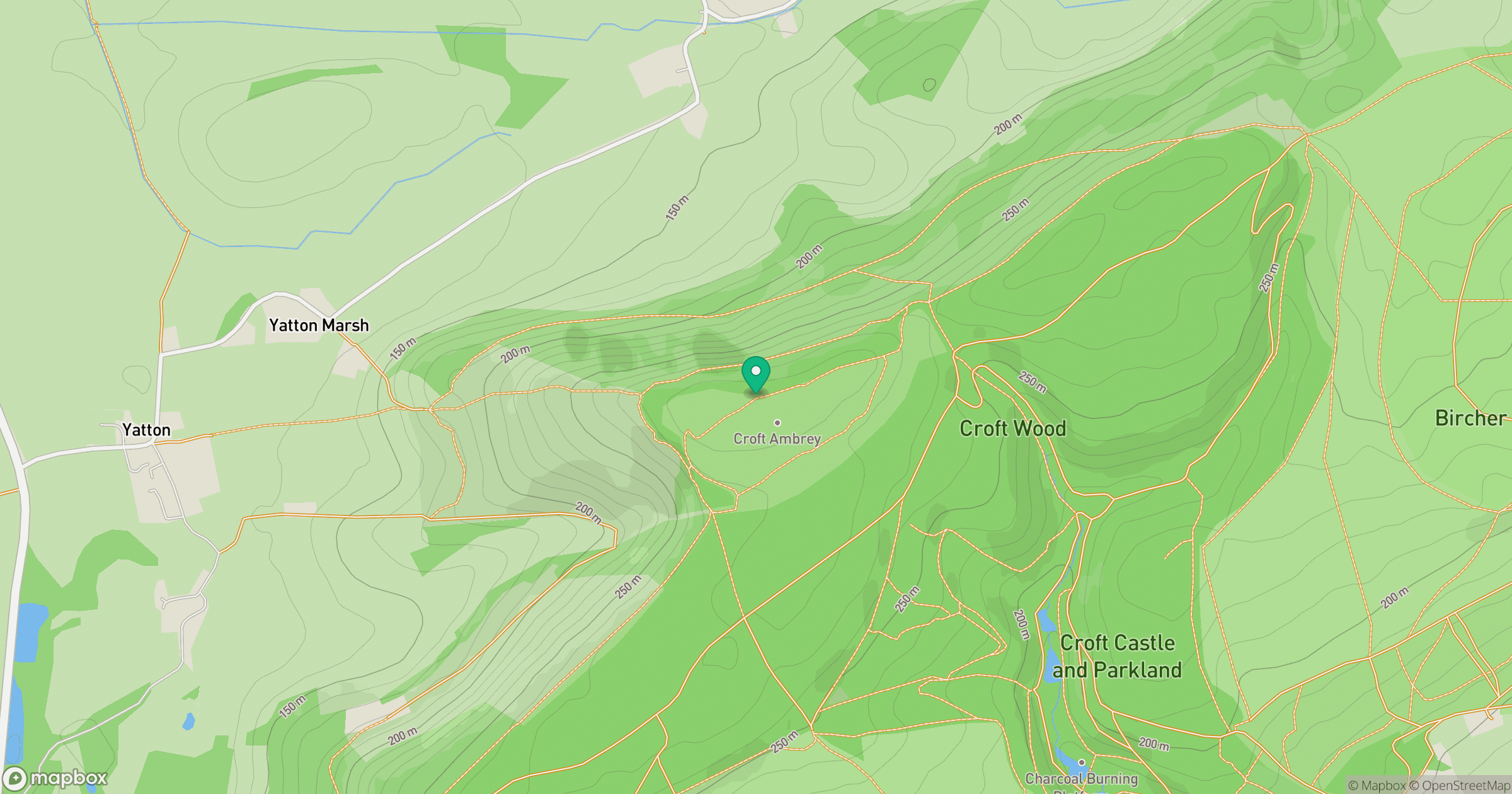
Grid reference: SO443668
View on OpenStreetMapOpens a map in a new tab, centred on the hill.
Nearby Hills
Titterstone Clee Hill
533m
Long Mynd - Pole Bank
517m
Stiperstones
537m
The Wrekin
407m
Worcestershire Beacon
425m
No comments yet. Be the first.